Reading Time: 4 minutes
Overview
Western Australia is the largest state and much of it is extremely dry. Most bushwalks are in the south-west corner which supports an outstanding range of wildflowers. North of Perth, there are vast distances to reach other interesting walking areas. One of the easiest ways to access those in the far north is through organised tours.
Climate
Western Australia has a diverse climate. It’s tropical north experiences dry and wet seasons while in the south the temperate conditions are characterised by hot, dry summers and mild, rainy winters. The areas to the east and away from the coast are usually very dry.
Bushwalking areas and notable walks
Southern Coastline
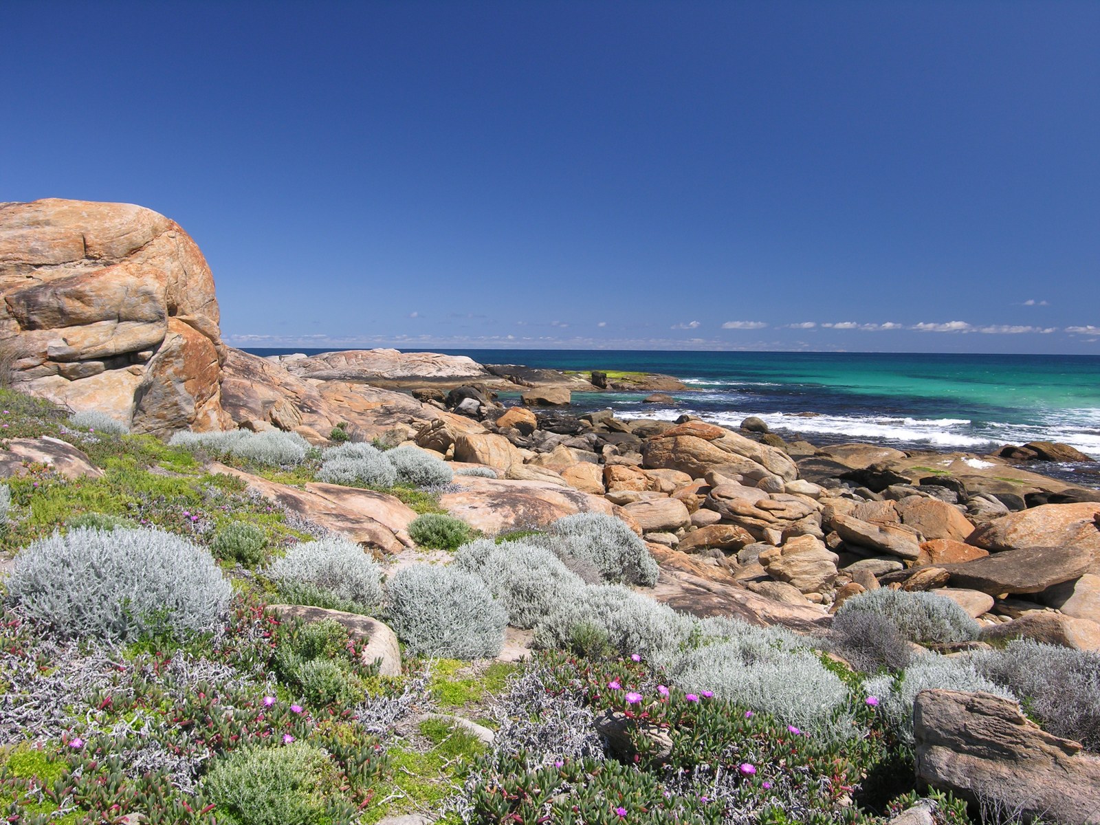
A series of national parks along the coast provide excellent wilderness-style extended walks. D’Entrecasteaux, Walpole-Nornalup, Fitzgerald River and Cape Le Grand are the major parks. One-day walks are also possible. Spring and autumn are the best walking seasons.
South west Western Australia
Cape to Cape Track is a marked, five-day walking track that follows the coast from Cape Naturaliste to Cape Leeuwin. The track passes close to Margaret River and has many access points so is also good for shorter walks.
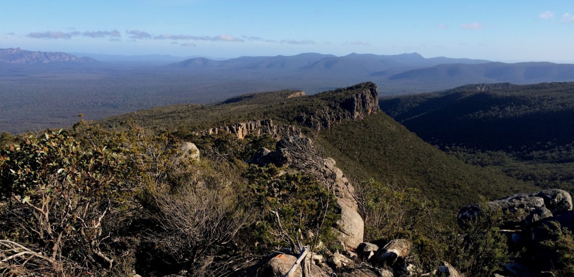
Stirling Range National Park contains the only major mountain range in the southern half of Western Australia. The west end provides excellent one-day walks to the isolated summits such as Bluff Knoll, the highest in the range. The park is best visited in spring for the profusion of wildflowers, many of which grow nowhere else. Stirling Range Ridge Walk is a rough, three-day, ridge-top traverse of approximately 26km. This unmarked route, also known as the Eastern Peaks Ridge Route, begins from the north-east corner of the park and rises on to Ellen Peak and finishes at the Bluff Knoll car park. It is suitable only for experienced walkers.
Perth Hills
The Perth Hills are a part of the Darling Scarp directly east of the city and have some good one day and overnight walks based on the Bibbulmun Track.
Bibbulmun Track is a marked walking track of almost 1000km from Perth to Albany and takes about seven weeks to walk. Three-sided timber shelter huts, tank water and pit toilets are provided at campsites. The track passes through a number of towns along the way as well as karri and tingle forests and long stretches of coastal heathlands. Best time to walk the track is spring when wildflowers are in abundance, but autumn and winter can also be enjoyable.
Monadnocks Conservation Park has the granite peaks of Mounts Cuthbert, Vincent and Cooke on the Bibbulmun Track that make good destinations for one-day and overnight walks.
Coral Coast
The scenic gorge of the Murchison River is the main feature of the Kalbarri National Park north of Perth. Most walks follow the river and range from one to five days. Suitable most of the year except summer when it is very hot and dry.
Northern Western Australia
The Kimberley is a huge tropical wilderness area with many rivers and plateaus to explore. Access is difficult due to distance and road conditions in the wet and is better suited to extended walking trips in the dry season.
The Purnululu National Park is known for the rounded, rocky domes that dominate the Bungle Bungle Range. Walking is confined to the narrow canyons and gorges with a number of popular one-day walks. However, well-prepared walkers can enjoy the walk along Piccaninny Creek for an overnight camp. Limited access to the area is by four-wheel drive only. Suitable for the dry seasons of autumn to spring.
Short walks are possible in Windjana Gorge National Park and Mirima National Park.
Local hazards
Crocodiles
In northern Australia, crocodile attacks have resulted in many fatalities. Take great care near any creek, river, estuary or inlet.
Unless expert local advice and signage confirms that the location is safe from crocodiles:
- DO NOT paddle, wade, swim or attempt to cross.
- DO NOT loiter or camp on the bank.
- DO take note of warning signs.
- DO supervise children closely.
Crocodiles are a risk in Western Australia north of Port Hedland, the Northern Territory north of Katherine and in Queensland north of Rockhampton.
Further information: Saltwater or estuarine crocodiles – Australian Museum
Cyclones
Cyclone season in northern Australia is generally from November to April. A cyclone is an intense low-pressure system with gale force and higher winds moving in a clockwise direction around the eye. Cyclones can bring destructive winds, torrential rain and flooding, tornadoes and storms, and a storm surge along coastlines where the sea level can be raised much higher than normal.
During the cyclone season be especially alert and monitor the local news broadcasts and weather warnings. See the links and apps below.
Emergencies
See also
Ambulance cover: essential for all bushwalkers
Interstate visitors should check that their home state or territory ambulance cover has reciprocal arrangements. St John WA provides Western Australia’s ambulance service.
International visitors should confirm they have travel insurance that covers bushwalking.
Current weather, emergency and safety information
Well prior to a trip, each group member should, on their mobile phone*:
Install the Bureau of Meteorology weather app:
- BOM Weather – Google Play
- BOM Weather – Apple App Store
Bookmark the websites below, which provide current local advice and emergency warnings.
- Emergency WA warnings and incidents – Emergency Western Australia
- Western Australia weather and warnings – Bureau of Meteorology (or the app above)
- ABC Emergency – current local emergency information from the ABC
- Current tropical cyclones – Bureau of Meteorology
- Tropical cyclone outlook – Bureau of Meteorology
- Road conditions and closures – Main roads Western Australia
- Prescribed burning – Department of Biodiversity, Conservation and Attractions, Western Australia
- Current air quality – Department of Water and Environment Regulation, Western Australia
*Useful only when there is phone network coverage.
References and external links
- Bushwalking safety – Western Australia Parks and Wildlife Service
- Bushwalking – Western Australia Parks and Wildlife Service
- You’re welcome – Access WA – guide to Parks for people with disability
- Topographic maps – Landgate Western Australia
Bushwalking peak body
Bushwalking WA – provides general information on bushwalking and the State’s bushwalking clubs.